![]()
NETIS Registered ProductRegistration Number: HK-150012-A
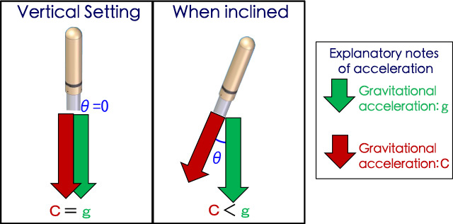
Measuring changes of inclination angle and direction at arbitrary intervals.
- The slope which has the great risk of the SEDIMENT DISASTER such as mountain, developed land and road slope etc.
- Structures such as bridge piers and steel tower
Measuring Procedure
- Measuring the inclination angle by using the inclination sensor (biaxial accelerometer).
- Measuring the inclination direction by using electronic compass
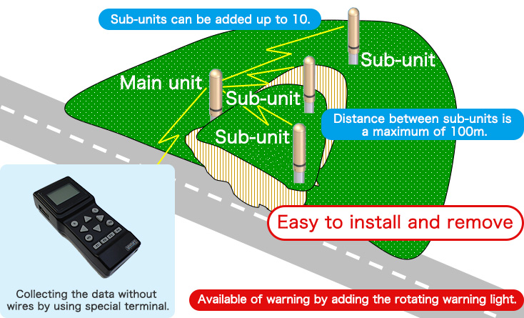
Change in slope is continuously observable without wires
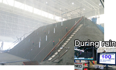
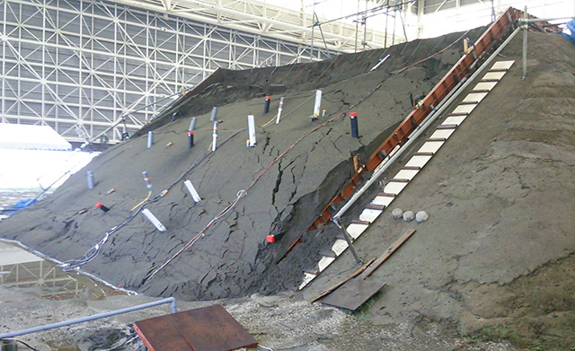
Participated in the landslide experiment by heavy rain at NIED (at Tsukuba).
Slope before collapse
![]()
![]()
Landslided slope
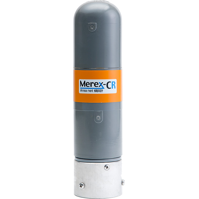
Device Specification
*Please see the table by scrolling horizontally.
| Model name | Inclinometer Merex-CR | |
|---|---|---|
| External size | Φ70×280mm | |
| Weight | 0.8kg | |
| Dustproof and waterproof specification | IP66 | |
| Ambient temperature | -20~+50℃ | |
| Source voltage | DC12V | |
| Inclination angle measurement | Displacement range | ±30° |
| Resolution | 0.025° | |
| Accuracy | ±0.5° | |
| Azimuth measurement | Displacement range | 360° |
| Accuracy | ±15° | |
| Laser output | - | |
| Measurement specification | Distance | |
| Displacement range | ||
| Resolution | ||
| Accuracy | ||
Measurement record interval(set by selecting optionally) |
1min./5min./10min./30min. 1hr./6hr./12hr./24hr. |
|
| Number of recorded data | 10,000 data | |
*Please see the table by scrolling horizontally.